Day 46 – Sunday, July 9
 PCT mile 767.0 Crabtree Meadows to PCT Mile 782.5
Day Total: 15.5 Miles
The thing about staying in the same tent site two nights in a row is that you manage to really unpack.
Getting everything sorted and put back in our packs took us a good while. We also ran into some friends we made at Kennedy Meadows who got in late the night before and were heading up Whitney that day. We finally started back towards the trail around 8:30.
We had a pretty incredible morning.

The Sierras do not disappoint. Our plan was to get over Forrester Pass, the highest point on the PCT.
Before Forrester though, we had three creeks to ford. The app we use to help us navigate also has water sources. Often times it will note a seasonal stream that may be dry. A note on 2017: no seasonal stream is dry. Streams are gushing and creeks are rivers. This makes the fords one of the more challenging and disconcerting aspects of the trail.

The first two creek crossings, Wallace Creek and Wright Creek, were within a mile of each other and weren't very difficult – the second required going about one-tenth of a mile downstream to find a safer crossing. After the second crossing, we stopped for breakfast and coffee. Starbucks via instant has made our mornings much more enjoyable.

After breakfast we ambled on amongst marmots and deer and, for a time, forgot we had ever been in the desert. We made it to Tyndall Creek and referenced the snow and ford report (like the water report, other hikers send in info on crossing creeks and snow con ditions) to see what it recommended. It suggested going upstream for seven-tenths of a mile and, given the surging water we couldn't hear each other over, we headed that way. Before long we found a place where the "creek" widened and we could safely cross.
We did some cross country hiking until we found the trail again and pushed on to Forrester.
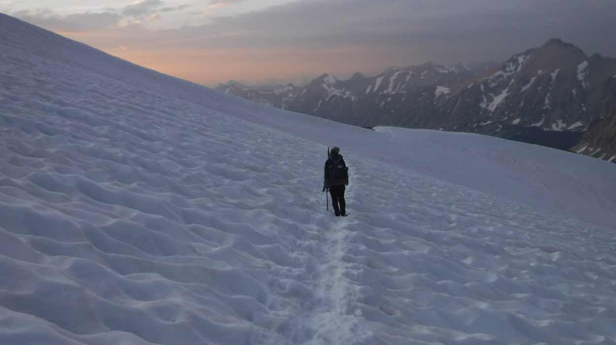
A couple miles after Tyndall Creek we hit snowfields that would come and go on our way to the base of Forrester. The trail appeared and disappeared several times and we followed the shoe and pole prints of those who went before us. Slogging through the snow slowed us down a considerable amount.

We got to the base of the pass and filled water right from the trail as it had become the chosen route for the snowmelt. With a liter of water and Snickers scarfed down we headed up the pass.
Not long into the ascent dark clouds started gathering above a nearby ridge. Soon thunder reverberated through the mountains surrounding us and continuing upward was not a sound decision.
We abandoned the trail for a more direct route down and, finding a flat enough spot, we set up our rain fly and collected ourselves. We gave ourselves a 7 p.m. deadline that, if the weather didn't improve, meant we'd camp where we were until morning. By 6:30 p.m. blue skies poked through in the direction we were headed and we moved.
 We only had to cross open snowfield midway up the pass amongst the switchbacks before having dry trail to the top.
The views were stunning and worth the effort.
On the north side of the pass was Kings Canyon and significant snow. We were higher than we hoped to be with the sun setting but we had gone over the pass. We followed the footprints down the mountain, found rock islands, then more snowfields. Before long we needed headlamps to continue.
By 9:30 p.m. we came to faintest of tree lines around 12,000 feet and found a flat spot near a glacial lake to make camp.


Comments
Post a Comment